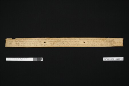
ເນື້ອໃນກ່າວເຖິງ ການໝາຍເອົາເຂດແດນໃນຂົງເຂດເທດສະບານນະຄອນຫລວງພະບາງ ໃນສະໄໝນັ້ນພະຣາຊາໄດ້ອີງໃສ່ພູຜາປ່າໄມ້ແລະຫ້ວຍນໍ້າລໍາຄອງເປັນຫລັກໝາຍເຂດແດນ. ສັງກາດໄດ້ຮ້ອຍ ໕໐໒ ຕົວປີ ເດືອນ ໑໐ ຂຶ້ນ ໑໓ ຄໍ່າ ວັນ ໓ ພະຣາຊະອາຍາລ່າຍຈຸ້ມ ສົມເດັດບໍຣົມມະບໍພິດເປັນເຈົ້າຕົນເປັນພະ ຊື່ວ່າ ວໍລະ ມີພະຣາຊະສັດທາໄດ້ປະສິດທິຈຸ້ມດວງນີ້ຫຼືຜູກນີ້ໄວ້ກັບວັດຊຽງຍືນ ເຂດແດນບ້ານເມືອງ ໄຮ່ນາ ດິນດອນຄະນອນເມືອງ ແຕ່ສົມເດັດໄຊຍະເສດຖາທິຣາດເຈົ້າຕົນເປັນພະຣາຊະປິຕາ.
The content mentions the demarcation of boundaries in the municipal area of Luang Prabang capital. At the time, the kings relied on the forest mountains and the canals as boundary markers. In Sangkat 1502, on the thirteenth day of the waxing moon of the tenth month, the third day of the week (Tuesday). The royal decree of Somdet Borommabophitta, the royal king named Vola had the most religious faith to give this manuscript to Xiang Yuen temple with the boundary of village, rice fields and land followed his father Somdet Saiyasetthathiraja.
Extent: 1 palm-leaf manuscript containing 4 leaves.
Size and dimensions of original material: Hight 5 cm, width 28.1 cm, depth 0.3 cm.
Condition of original material: Good.
Author(s)/Creator(s): Unidentified.
Scribe(s): Unidentified.
Original institution reference: Manuscript Cabinet No.1.