Search results
Archive type
Content type
Related places
Languages
Scripts
Showing 1 to 15 of 128 results
-
Maps and Plans [Late 19th century-early 20th century]
Description: Late 19th and early 20th century. Probably to accompany sales of property. Hand drawn by surveyors. Extent and format of original…
-
Thak Maps Volume 21 [1848-1850]
Name of Pergunah covered in album: Bungaon; Taigachee; Islampur. There are 42 mauza (revenue units) in the album. Extent of Original material:…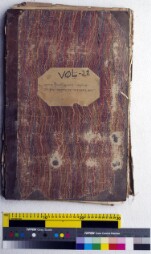
-
"Peta Sebidang Tanah Dusun [Hari Isnin, 26 1303 Hijriyah]"
Digital images of a map showing an orchard and its surroundings. Dated Hari Isnin, 26 1303 Hijriya. Notes: Thick woven paper. Framed with a black…
-
Request for certifide map copy of Muslim burial ground
Request and grant of certified map copy of Muslim burial ground below Arithang, Gangtok. Original file reference: SPA/LA/PE/063. Extent of original…
-
Thak Maps Volume 30 [1848-1850]
Name of Pergunah covered in album: Taherpur; Chindabajhoo. There are 34 mauza (revenue units) in the album. Extent of Original material: Bound…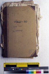
-
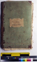
Thak Maps Volume 44 [1848-1850]
Name of Pergunah covered in album: Kalligaon; Kalligaon Kalisha. There are 118 mauza (revenue units) in the album. Extent of Original material:…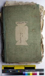
-
A map of the historical development of the Kingdom of Serbs, Croats and Slovenians [1922]
This map is issued as an attachment to the Vardar calendar for year 1923. Volume and issue/Extent of original: Vol. 42, year 1923; 1 item.…
-
Thak Maps Volume 24 [1848-1850]
Name of Pergunah covered in album: Tappah Chapeela; Bhathooreea. There are 20 mauza (revenue units) in the album. Extent of Original material:…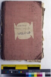
-
Thak Maps Volume 16 [1848-1850]
Name of Pergunah covered in album: Amrool. There are 108 mauza (revenue units) in the album. Extent of Original material: Bound volume containing…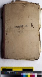
-
Thak Maps Volume 9 [1848-1850]
Name of Pergunah covered in album: Changaon (Bungaon) and unreadable Pergunah. There are 2 mauza (revenue units) in the album. The names of mauza…
-
Peta Tiga Bidang Tanah
Site map for a land grant, date and cartographer unknown. Double folio paper, map on one side only. Watermark: elephant (Guthrie).…
-
Thak Maps Volume 13 [1848-1850]
Name of Pergunah covered in album: Lashkorpur (Lushker Poor); Kazihatta and untraceable Pergunah. There are 49 mauza (revenue units) in the album.…
-
Maps of lands plots in Namphok block
Sketch of land holdings and details of their holdings. Original file reference: SPA/LA/LR/108. Extent of original material: 8 pages.…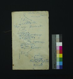
-
Thak Maps Volume 22 [1848-1850]
Name of Pergunah covered in album: Gururhat. There are 83 mauza (revenue units) in the album. Extent of Original material: Bound volume containing…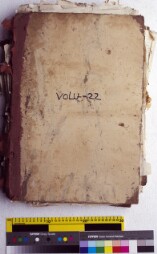
-
Thak Maps Volume 26 [1848-1850]
Name of Pergunah covered in album: Lushkerpoor. There are 48 mauza (revenue units) in the album. Extent of Original material: Bound volume…