Search results
Archive type
Content type
Related places
Languages
Scripts
Showing 1 to 8 of 8 results
-
A map of the historical development of the Kingdom of Serbs, Croats and Slovenians [1922]
This map is issued as an attachment to the Vardar calendar for year 1923. Volume and issue/Extent of original: Vol. 42, year 1923; 1 item.…
-
Chiromo Graves
Sketch Map of Port Herald Cemetery.Extent: 1 file containing 10 Pages.Condition of original material: there arePunched holes;Stained;Faded.Author(s…
-
Map of Ghana. Sheet No. 0403B2. Exhibit “M”
Map of the coastal area of Ghana near Axim. Scale 1:50.000. Indications: "Sheet History. Prepared jointly by the Government of Ghana and the…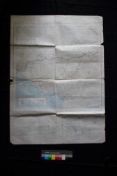
-
Mapa de Bolivia y Norte Argentina por Pedro León de Santiago Alaves.
Regional map depicting Bolivia and northern Argentina, created by Pedro León de Santiago Alaves, with geographic and political details.Mapa…
-
Plano de la batalla de Maipú.
Topographic and strategic map of the Battle of Maipú, showing troop locations, routes, and relevant geographical features for military planning.…
-
Mapa general de Sudamérica.
Broad map showing the political and physical geography of South America in a given historical context.Mapa amplio que muestra la geografía política…
-
Plano e información de la batalla de Vilcapuguio, realizada el 01 de octubre de 1813 entre el Ejército Nacional del Perú, dirigido por Joaquín de la Pezuela, y los insurgentes de Buenos Aires.
Document detailing the plan and information of the Battle of Vilcapugio, held on October 1, 1813, between the National Army of Peru led by Joaquín…
-
Carta geográfica de las campañas de Alvarez de arenales (1820-21).
Geographic maps illustrating military campaigns and strategic troop movements, providing valuable historical resources.Cartas geográficas que…