Archival records from Digital preservation and cataloguing of early printed Armenian maps, periodicals and newspapers, and making them accessible online (EAP613)
Archive type
Content type
Languages
Scripts
Showing 421 to 435 of 547 results
-
"Asia, Georgia, Armenia: Nieuwe Kaart van Geheel Georgië eertijds Colchis, Iberié en Albanië als mede van Armenië en medië Ասիա,Վրաստան, Հայաստան.Վրաստանի՝ նախկին Կոլխիսի, Իբերիայի և Ալբանիայի, ինչպես...
Rare map of the area between the Black Sea and the Caspian Sea. Contemporary colourin. Publisher: S.l, S.n.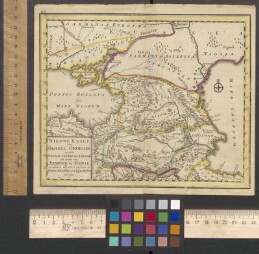
-
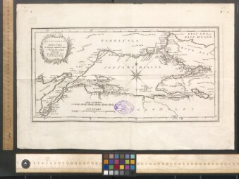
Neghuc‘ Kostadnupolsoy Նեղուց Կոստանդնուպօլսոյ 1791
The Bosporus of Constantinople. Author: Alessandri. Publisher: S.n.,Venice.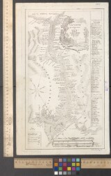
-
Asxarhac‘oyc‘ Osmanean terut‘ean Աշխարհացոյց Օսմանեան տերութեան 1791
Map of the Ottoman Empire. Author: Alessandri. Publisher: S.n., Venice.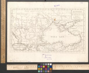
-
Cucak avurc lusni Ցուցակ աւուրց լուսնի 1792-1793
List of the moon''s days. Publisher: S.n., S.l.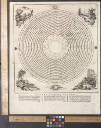
-
"Carte von Syrien. Mesopotamien end einem Theile von Persien Սիրիայի, Մեսոպոտամիայի (Միջագետք) և Պարսկաստանի քարտեզ 1805"
Map of Syria, Mesopotamia and Persia. Publisher: S.n., Weimar.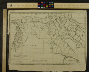
-
"Turkey, Armenia, Syria, Israel, Iraq: A Vuillemin-Asia Mineure Թուրքիա,Հայաստան, Սիրիա, Իսրայել, Իրաք. Վուլեմին-Փոքր Ասիա 1843"
Contemporary coloured steel engraving of the western part of the Middle East. Publisher: S.n., S.l.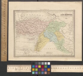
-
Plan osadi i vzatiya pristupom kreposti Karsa Rossiskimi voiskami pod predvoditelstvom general feldmarshala grafa Paskevich Erivanskago iyunia 23 go dnya 1828 goda Ռուսական զորքերի կողմից՝ գեներալ-ֆել...
Plan of the siege and capture of the fortress of Kars on June 23 of 1828 by Russian troops, led by General Field Marshall graf Paskevich Erivanski…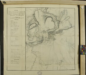
-
Plan osadi kreposti Akhalcikha s 5 go po 15 avgusta i vzyatiya onoi pristupom 15 go sego je mesyaca Rossiiskimi voyskami pod predvoditelstvom generala feldmarshala grafa Paskevichi Erivanskago 1828 go...
Plan of the siege of the fortress of Akhaltsikhe from 5 to 15 of August of 1828 and capture in the same month by Russian troops, led by General…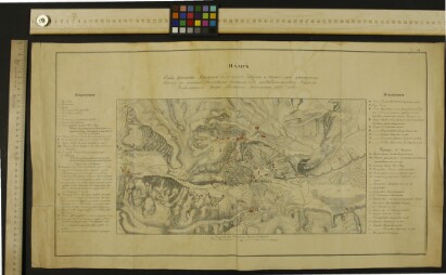
-
Hayastan ashkharh Հայաստան աշխարհ: Ըստ նախնի աշխարհագրաց 1849
Armenian world. According to the former geographers. Publisher: Printing house of St.Lazarus, Venice.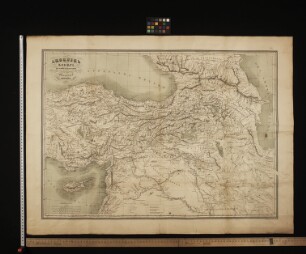
-
"Hartagundq.Kisagunt1.Erkri,2.Erknic,3.Mecagoyn masin camaqi ev jroy,4.Kopernikean karg molorakac, 5.Erkragund, 6.Barcrutivnq leranc,7.Hamematakan patker metsagoyn getoc. Հարթագունդք: Կիսագունտ1.Երկրի...
Different geographic data. Publisher: Printing house of Mkhitaryean miabanutean,Vienna.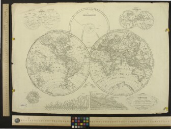
-
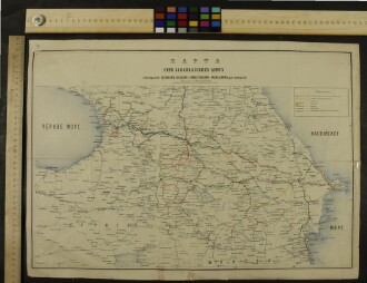
Gidrographicheskaya karta Zakavkazya I Chernomorskago poberejya Անդրկովկասի և Սևծովյան ափերի ջրագրական քարտեզ 1850-1900?
Hidronomic map of caucas and Black sea''s beach. Publisher: S.n.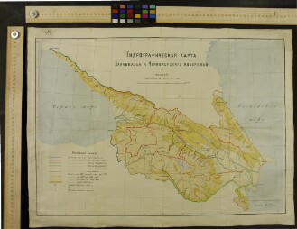
-
"Die Asiatische Turkei die Kaukasuslander u. West-Persien Ասիական Թուրքիան, Կովկասյան երկրները և Արևմտյան Պարսկաստանը 1853"
Caucasian countries and one part of Near East. Publisher: S.n.,Weimer.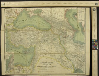
-
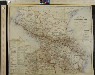
Karta Kavkazskogo kraya Կովկասյան երկրամասի քարտեզ 1868
Map of Caucasian region. Publisher: S.n., Moscow.